


Precinct 58A, Yellowstone County, Montana
About
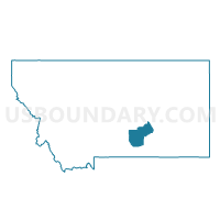
Outline

Summary
| Unique Area Identifier | 612356 |
| Name | Precinct 58A |
| County | Yellowstone County |
| State | Montana |
| Area (square miles) | 71.47 |
| Land Area (square miles) | 71.08 |
| Water Area (square miles) | 0.39 |
| % of Land Area | 99.45 |
| % of Water Area | 0.55 |
| Latitude of the Internal Point | 45.70256150 |
| Longtitude of the Internal Point | -108.83296570 |
Maps


Graphs
Select a template below for downloading or customizing gragh for Precinct 58A, Yellowstone County, Montana


Neighbors
Neighoring Voting District (by Name) Neighboring Voting District on the Map
- Precinct 1, Carbon County, MT
- Precinct 2, Stillwater County, MT
- Precinct 46G, Yellowstone County, MT
- Precinct 57B, Yellowstone County, MT
- Precinct 57C, Yellowstone County, MT
- Precinct 58B, Yellowstone County, MT
- Precinct 58C, Yellowstone County, MT
- Precinct 58D, Yellowstone County, MT
- Precinct 58E, Yellowstone County, MT
- Precinct 7, Stillwater County, MT
Top 10 Neighboring County Subdivision (by Population) Neighboring County Subdivision on the Map
- Laurel CCD, Yellowstone County, MT (15,847)
- South Yellowstone CCD, Yellowstone County, MT (7,653)
- Northwest Yellowstone CCD, Yellowstone County, MT (7,558)
- Joliet CCD, Carbon County, MT (2,487)
- Park City CCD, Stillwater County, MT (2,331)
- North Stillwater CCD, Stillwater County, MT (767)
Top 10 Neighboring Place (by Population) Neighboring Place on the Map
Top 10 Neighboring Elementary School District (by Population) Neighboring Elementary School District on the Map
- Laurel Elementary School District, MT (11,043)
- Elder Grove Elementary School District, MT (3,014)
- Park City Elementary School District, MT (2,282)
Top 10 Neighboring Secondary School District (by Population) Neighboring Secondary School District on the Map
- Billings High School District, MT (127,987)
- Laurel High School District, MT (10,696)
- Joliet High School District, MT (2,386)
- Park City High School District, MT (2,082)
Top 10 Neighboring State Legislative District Lower Chamber (by Population) Neighboring State Legislative District Lower Chamber on the Map
- State House District 46, MT (13,942)
- State House District 57, MT (11,941)
- State House District 58, MT (10,094)
- State House District 60, MT (10,003)
Top 10 Neighboring State Legislative District Upper Chamber (by Population) Neighboring State Legislative District Upper Chamber on the Map
- State Senate District 23, MT (23,380)
- State Senate District 29, MT (22,035)
- State Senate District 30, MT (19,092)
Top 10 Neighboring 111th Congressional District (by Population) Neighboring 111th Congressional District on the Map
Top 10 Neighboring Census Tract (by Population) Neighboring Census Tract on the Map
- Census Tract 14.01, Yellowstone County, MT (9,227)
- Census Tract 9400, Yellowstone County, MT (7,653)
- Census Tract 19.01, Yellowstone County, MT (4,725)
- Census Tract 19.02, Yellowstone County, MT (3,819)
- Census Tract 9666, Stillwater County, MT (3,098)
- Census Tract 1, Carbon County, MT (2,487)